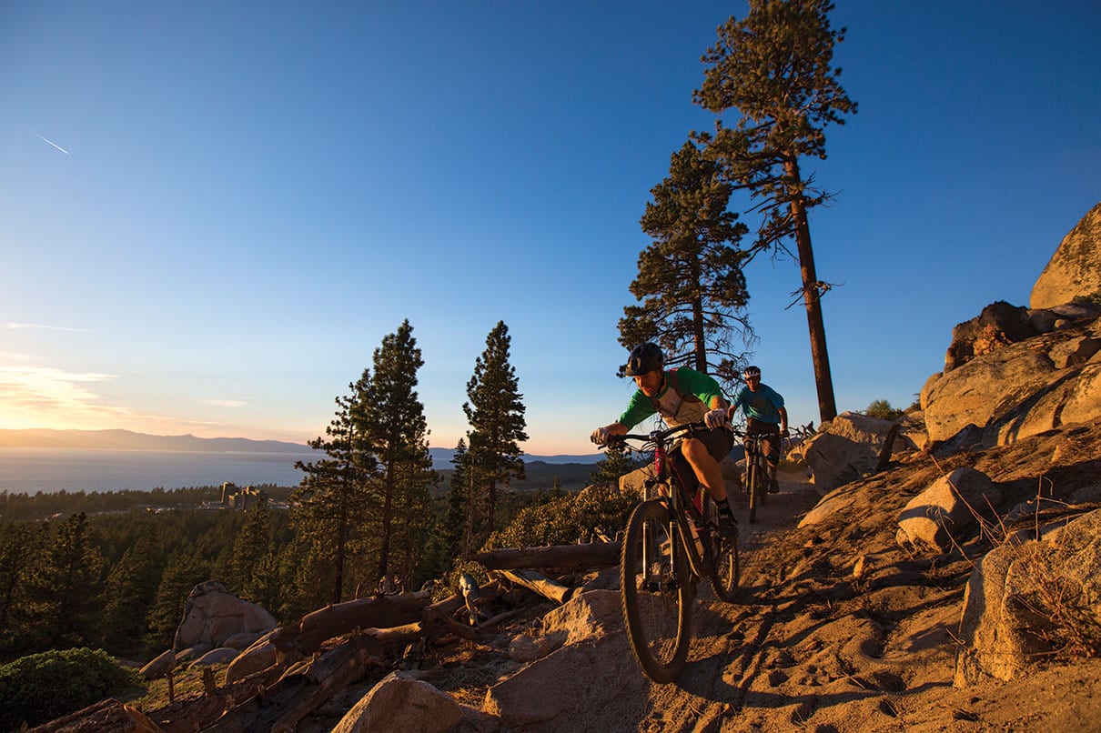
01 May State of the Singletrack
The greater Lake Tahoe region is experiencing a trails renaissance that’s been a long time coming
Ladies and gentlemen, fellow outdoor enthusiasts, members of the Singletrack Nation… From Lake Tahoe’s South Shore to its North, East and West shores, from Donner Summit to the Lost Sierra and points in between: The state of our trails is strong.
Indeed. Stick a pin in the center of Lake Tahoe, draw a 100-mile radius and tally the amount of trail groups, associations, stewardships and agencies and they add up surprisingly fast. The result? More than a dozen groups and hundreds of miles of trail getting funded, built and maintained as well as communities supported through an almost unheard of amount of cooperation.
While funding challenges and user conflicts remain, it’s not hyperbole to declare that the region is experiencing something of a Golden Age of Trails.
“I refer to it as a trails renaissance,” says Kevin Joell, a ubiquitous presence in the Reno-Tahoe trail-building scene for two decades.
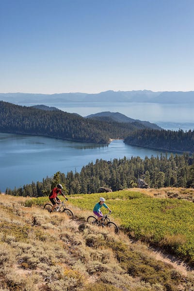
Many of Tahoe’s popular trails feature stunning views, like this section of the Tahoe Rim Trail above Marlette Lake, photo by Tom Zikas
How Did We Get Here?
In 2001, after nearly 20 years and more than 200,000 volunteer hours, the region’s singular singletrack—the full 165-mile Tahoe Rim Trail loop—was completed.
It took almost another decade after the Tahoe Rim Trail opening for citizen trail builders in the area to get asked to sit at the planning table. There’s some history there.
Considering the length of an average U.S. Forest Service employee’s career, multiple decades had to pass before a paradigm shift could occur in regard to trails, or at least for trails other than something as universally palatable as the Tahoe Rim Trail.
Through the 1990s and into the early 2000s, the vintage of federal land managers generally dictated public land management. This was the generation of resource extraction and the building of roads to extract said resources. Logging paid for itself—and buoyed whole communities. Building trail didn’t, so trails just weren’t in the cards. And if they were, it was a mere glimmer in the eyes of younger, ecosystem-oriented employees.
Ultimately, tight budgets meant less and less maintenance for existing trails, and even less for getting “legal” trails built on public land.
“Many agencies had personnel with a 20- to 30-year-old vision regarding trail design. It made it easy for them to say no because trails ‘were such a pain to maintain,’” says Joell, who now owns a trail consulting and contracting business. “There are a dozen different land managers I’ve worked with in the Reno-Tahoe area and nearly all of them had people that understood—or came to understand—the difference between an old skidder road used for logging and a sustainable singletrack that would be an attraction in itself.”
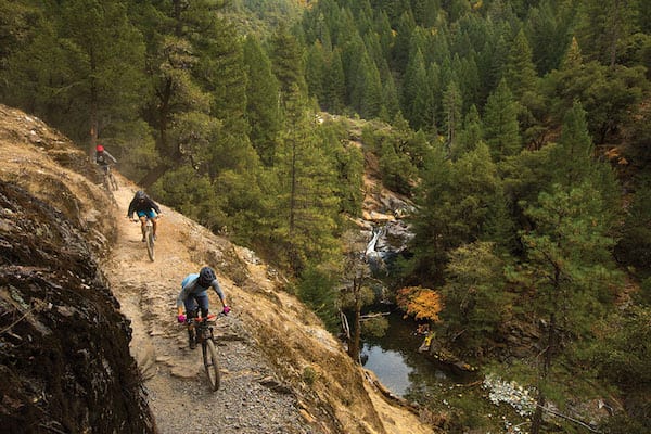
The Specialized team tests bikes on the renowned Downieville Downhill, photo by Ryan Salm
Trees, Trails or Bust
Attracting trail users to a renown recreation destination is one thing. Tahoe simply sells itself. But for Greg Williams and the Sierra Buttes Trail Stewardship, singletrack is proving to be economic salvation for parts of the Sierra struggling to survive.
In the early 1990s, Williams started guiding mountain bikers on the old mining trails above Downieville, a 170-year-old Gold Rush hamlet some 75 miles northwest of Tahoe. About the same time, logging on public lands was essentially shut down due to the proxy wars fought over the spotted owl. With the precipitous decline in timber receipts came the fall-off of trail maintenance by the Forest Service.
Closed trails began threatening Williams’ increasingly popular Yuba Expeditions mountain bike shuttle business, and along with it the economic boost Downieville was experiencing from visiting cyclists on their $5,000-plus mountain bikes. Williams launched what is now the Downieville Classic mountain bike race in 1998, with entry fees going to trail maintenance. Out of that wildly successful event, the Sierra Buttes Trail Stewardship was born in 2003.
Sixteen years later the Stewardship, of which Williams is executive director, employs full-time trail builders and development staff, manages events, and is considered a shining light not just for land managers and mountain bikers, but user groups throughout the West.
The Stewardship no longer just builds trails. In economically moribund Sierra and Plumas counties, the “Tribe,” as its legion of longtime volunteers call the Stewardship, is on a mission.
“We’ve evolved from where it was solely about the trails to now the trails are a tool for economic development,” Williams says. “Right now we’re losing population, losing families. Jobs used to come from public lands with resource extraction. Those jobs are gone. How do we get jobs back?”
Trails, of course.
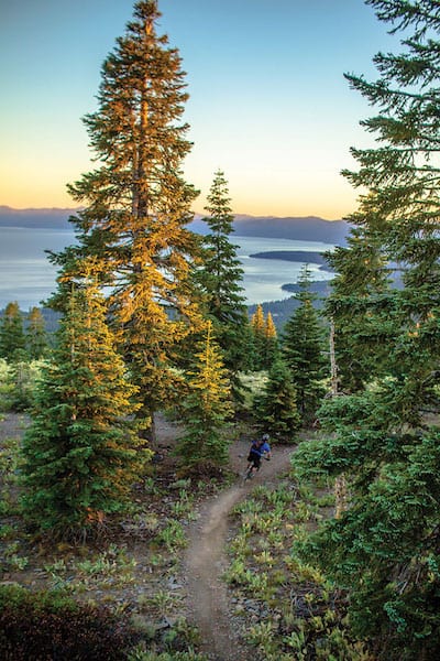
Kevin Bazar rolls past fir trees along the granddaddy of the region’s trails, the Tahoe Rim Trail, above Kings Beach, photo by Pat Branch
Watershed Moment
For the Tahoe Basin, something of a generational and philosophical breakthrough occurred in the fall of 2010, almost a decade after the Tahoe Rim Trail was completed.
The Tahoe Trails Summit was convened by the Forest Service and International Mountain Bicycling Association to discuss the applicability in Tahoe of a few successful, sustainable trails and bike parks around the country. That’s because other than the Tahoe Rim Trail, trail management in the Basin had turned into a game of Whac-A-Mole for the Forest Service.
“We were doing trail work but we were also seeing a proliferation of illegal trails being built,” says Jacob Quinn, a trails specialist with the Lake Tahoe Basin Management Unit. “The only money we were spending at that time was actually closing down illegal trails. It didn’t seem it was working out very well.”
The catalyst, Quinn says, came in 2009, when a young mountain biker suffered a spinal injury on an illegal trail above Lake Tahoe and was airlifted to a hospital.
“That was the final trigger point for doing something different,” Quinn says.
The difference came in the form of the summit and, as Quinn says, the Forest Service “rethinking mountain biking in the Basin.” That fresh philosophy was spearheaded by public employees who recreated differently than their predecessors.
The long-needed “cultural shift” at some Forest Service districts was happening. But for it to blossom fully in the Basin, the Tahoe Area Mountain Biking Association, or TAMBA, needed to be resurrected after being dormant since 2003. With its roots going back to the first heyday of mountain biking, TAMBA’s volunteer base just needed encouragement to reform.
“At the end of the summit they asked anyone interested in creating a mountain bike group to stick around,” says Joell, the area’s long-suffering trails advocate. “We had a round-table meeting and you could feel the energy in the room.”
The summit, Quinn says, got things rolling: “It was the right time and the right people.”
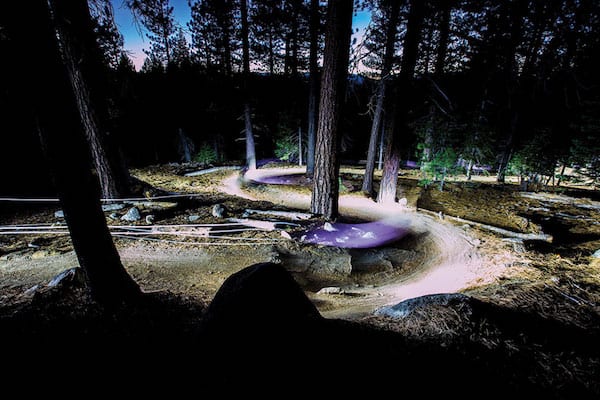
A mountain biker glides through switchbacks on the Corral Trail at dusk, photo by Ryan Salm
Progress At Last
After the trail summit, TAMBA was back, but getting shovels in the ground didn’t happen overnight.
“It was more of a slow transition, trying to build up the trust and reputation of mountain bike trail volunteers,” Joell says. “That was a major stumbling block with several agencies that had a bad taste in their mouths from the building of some of the unauthorized trails.”
Through hard work, communication and cooperation, Joell says trust grew to the point that TAMBA became the go-to contact for trail issues in the Basin.
“It had a lot to do with the staff person in charge of trails for each agency,” he says. “‘No’ was the easy answer, and then slowly some of the people that always said ‘no’ retired or left and were replaced by people that valued trails and cooperative projects.”
People like Quinn. Born in Truckee and raised on the west slope of the Sierra in Colfax, Quinn managed backcountry trails in the Inyo National Forest before transferring to the Tahoe Basin as trails program manager.

Lee Collins takes to the air on the Corral Trail, photo by First Tracks Productions
“I grew up camping, hiking and fishing all over the Tahoe National Forest and loved every minute of it. It felt like my backyard,” Quinn says. “So, yeah, I feel a sense of pride in managing for sustained public access, giving back and acting as a steward for the places I grew up loving.”
That doesn’t mean, however, that Quinn and his fellow feds are going willy-nilly on trail building. A bureaucratic concept called “risk management” is always in play and guides projects, such as the precedent-setting Corral Trail in South Lake Tahoe in 2014.
Out in the Lost Sierra, meanwhile, Williams and the Sierra Buttes Trail Stewardship experienced their own ups and downs with land managers. But when the Stewardship partnered with TAMBA to build the Corral Trail, Williams knew patience and partnerships had finally prevailed.
Engineered with an acceptable amount of risk and to rehab an area rife with erosion, the jumps, berms and rollers on the Corral Trail represented a first-of-its-kind project in the nation smack dab in the middle of the Tahoe Basin, one of the most heavily regulated watersheds anywhere.
“If you can do it in the Tahoe Basin you can replicate it any place in the world,” Williams says. “Don’t tell me you can’t do it in Portola.”
Can’t We All Just Get Along?
Another thing that sets the Corral Trail apart is that it’s open to motorcycles, mountain bikers, hikers and equestrians. Creating multi-use trails is something Christina Thayer knows all about.
Thayer is the trail manager for the 6,000-home Tahoe Donner Association in Truckee, where many homeowners view trails as an amenity as valuable as a recreation center or golf course. Yet adding more singletrack is a bone of contention for others, even though motos aren’t in the equation on Tahoe Donner property.

Singletrack with a view high above South Lake Tahoe, photo by Ryan Salm
In her career building and maintaining trails in Oregon and California, Thayer says there’s one incontrovertible constant that, depending on one’s point of view, is either a positive or negative.
“Mountain bikers tend to dominate the conversation, but mountain bikers also do most of the volunteer trail work,” she says. “It’s really difficult to make everybody happy, whether it’s hikers, equestrians, runners or mountain bikers. Why not just be happy there are trails?”
Cooperation across user groups is something the Stewardship figured out early on in order to be successful. And as Thayer points out, the amount of people using shared trails is only increasing.
All of which makes a pragmatic approach to planning even more important.
“We’re all entering this new chapter of trail design and implementation and we’re spending a lot of money and manpower on trails,” Thayer says. “I think what’s happening here now is it’s never been as organized, and the amount of trails and people getting out there is exponentially on the rise. You can equate that to (trail mapping) apps, but as land managers you can’t turn a blind eye to it, so that forces us to get together.”
Pragmatism, again, rules. The Lake Tahoe Basin Management Unit sees the highest amount of visitation of any national forest in the United States, with nearly 10 million visitors each year. Every trail in the Basin is shared-use, with some primarily mountain bike and others primarily motos, all open to foot traffic. So user conflict is almost inevitable.
“The key to that is setting expectations,” Quinn says. “The message we’re sending here is these are shared-use trails. We do get some pressure from some mountain bikers to develop exclusively downhill trail. But if we go down that path we’ll have every kind of trail for every single use.”
Bottom line: “If we’re not maintaining the trails we have now, we’re not going to be building anything new,” Quinn says. “The volunteers have really stepped up.”
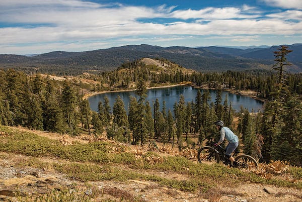
A rider takes in the view of Deer Lake on what used to be a section of the Pacific Crest Trail, which was officially rerouted in 2018. The new Gold Valley Rim Trail adds miles of multi-use singletrack to the Downieville trail system from Packer Saddle, photo by Ryan Salm
Trails, Vision, Connectivity
The Corral Trail was built with both sustainability and accessibility in mind. Quinn says that every feature is designed as an infiltration system. And novice to expert riders can experience the trail, which is adjacent to the largest population center in the Tahoe Basin. It also connects with a network of singletrack higher up the mountain for those seeking a big day on the bike.
With cooperation between all the various nonprofits and public agencies in place, wider connectivity is the next step for the region as a whole. Williams uses the term “front-country trails” to describe riding, running or hiking from a town to access a nearby trail system.
“We’ve completed more than 100 trails projects,” Williams says. “Now it’s time to think about bigger things.”
Among those bigger things is the Stewardship’s regional trails plan that envisions a network of interconnecting long-distance trails, with each anchored by a community such as Loyalton, Portola or Taylorsville. Users, be they hikers, mountain bikers or motorcyclists, would be able to pick and choose the town to visit and enter the trail there, or link up larger loops.
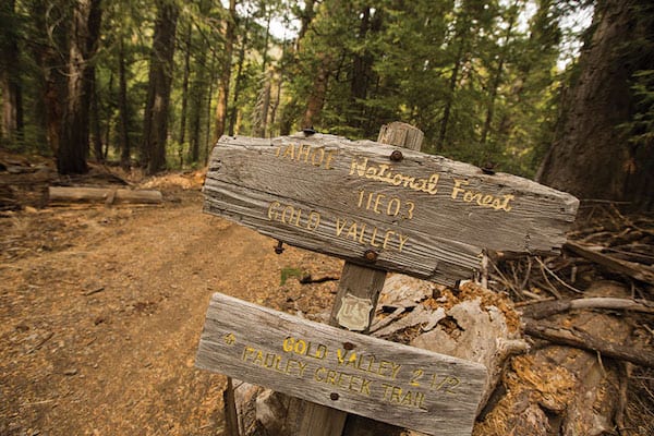
The Sierra Buttes Trail Stewardship maintains multi-use trails from the top of Packer Saddle near the Sierra Buttes all the way down to the town of Downieville, photo by Ryan Salm
The goal is to recreate the economic benefits that communities like Downieville and Quincy are experiencing from trail users. Instead of resource extraction, it’s recreation injection.
“When we introduce the regional masterplan,” Williams says, “everybody is going to be fired up.”
And even though the Stewardship’s wheelhouse is the Lost Sierra, it’s not operating in a vacuum. The Truckee Donner Land Trust is either in the process or has purchased ecologically important tracts of land that stretch far to the north of Truckee. The acquisition of Carpenter Valley, Perazzo Meadows and other holdings creates contiguous land management that provides connected swaths of habitat and protects important watersheds that feed the Truckee River.
And the Land Trust is aiming for more with the proposed acquisition of Frog Lake, Red Mountain and Carpenter Ridge in 2020, says Greyson Howard, the Land Trust’s communications director.
“We envision a trail stretching from the Warren Lake trail on Donner Summit down to Frog Lake, over Red Mountain, through Lower Carpenter Valley and all the way to Independence Lake,” Howard says. “From there, numerous possibilities linking to Mount Lola or the Pacific Crest Trail are on the horizon. All that adds up to a lot of new recreational opportunities.”
Echoing Williams’ statement about “bigger things,” Howard says that if the singletrack dream north of Truckee were to go even bigger, it would stretch to Webber Lake and down to Sierra City, where it would connect to the Stewardship’s network.
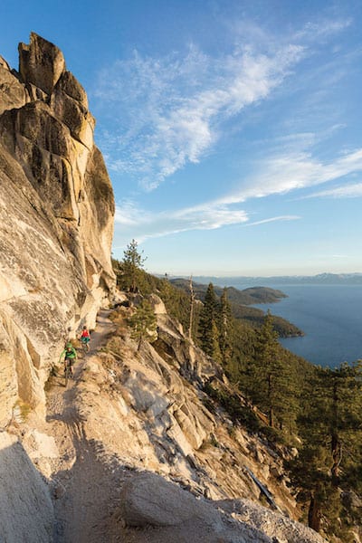
The scenic Flume Trail above Tahoe’s East Shore, photo by Tom Zikas
Bigger Things
When the Truckee Donner Land Trust starts blazing its northern trail and when the Sierra Buttes Trail Stewardship’s regional master plan finds its way into the woods, it will be almost exactly 40 years after Tahoe Rim Trail founder Glen Hampton, a Forest Service recreation officer, stood atop a mountain above Lake Tahoe and envisioned what would ultimately become an iconic destination trail.
As with Hampton and his vision for the Tahoe Rim Trail, monumental trails continue to be built throughout the Sierra landscape by passionate people such as Quinn, Joell and the volunteers of the Stewardship, TAMBA and other dedicated groups.
Ladies and gentlemen, fellow outdoor enthusiasts, members of the Singletrack Nation… The state of our trails is, indeed, strong.
Writing pays Jamie Bate’s bills. Riding keeps him chilled. For 15 years he’s shredded singletrack and syntax from his home base in Truckee. Contact him at jam.bate630@gmail.com.
Stewards of Trail
Trail doesn’t build itself. There are dozens of groups in the region that volunteer thousands of hours of work each year to build and maintain an ever-increasing interconnected network of trails. Anyone who pedals, strides, gallops or twists a throttle on these trails is encouraged to contribute to the efforts.
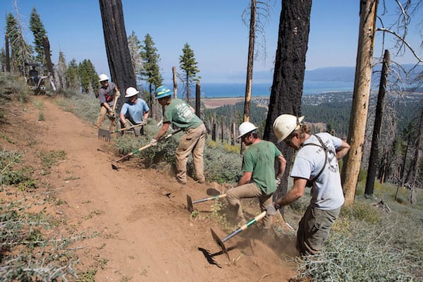
A TAMBA trail crew builds singletrack on Tahoe Mountain, photo by Ryan Salm
Tahoe Area Mountain Biking Association
TAMBA continues its partnerships with agencies and land managers in the Tahoe area and has a track record of building projects going back to 2011. In 2018, the group finished the Incline Flume, Red House Flume and Lake View trails along with creating the new Tamarack and Stanford Rock trails. TAMBA is working on a project connecting Angora Lakes to Lily Lake near Fallen Leaf Lake, called the Lily Lake Trail.
FUTURE: TAMBA is partnering with the Forest Service, Tahoe Fund, Truckee Tahoe Airport District and North Tahoe Public Utility District to complete a 2-mile project off Beaver Street in Kings Beach modeled on the multi-feature Corral Trail in South Lake Tahoe. The shared-use trail will address water quality on Griff Creek and expand trail linkage from the Tahoe Basin to Truckee. As part of its partnership with the Forest Service, TAMBA supplies the workforce to maintain and build trail.
Sierra Buttes Trail Stewardship
The Sierra Buttes Trail Stewardship is largely active in the Lost Sierra region, with the Downieville trail system being the crown jewel. Along with building the Mills Peak trail near Graeagle and maintaining a network of trails in the Lakes Basin Recreation Area, the Stewardship is investing considerable resources around Quincy. The Mt. Hough Trail features nearly 4,000 feet of vertical descent on 12 miles of multi-use trail. At the base of Mount Hough are the trails of South Park and Cascade Trail.
FUTURE: The Stewardship is in the early planning stages of the Mohawk Rim Trail, with the 20-mile phase one starting in Portola and traveling up to and around Beckwourth Peak with a trailhead at Nakoma Resort. Eventually the Mohawk Rim Trail will connect to the Mills Peak Trail. The Stewardship has a calendar of Trail Daze and Mountain Epics, where volunteers are treated to beer and trail work.
Truckee Trails Foundation
Founded in 2002, Truckee Trails Foundation ramped up quickly with the signature Truckee River Legacy Trail, a 6-mile Class 1 paved path that connects downtown to the Glenshire neighborhood. Truckee Trails Foundation led the way on a network of other Class 1 trails in town, including a 1-mile stretch along Trout Creek that connects downtown to Tahoe Donner. In 2018, the foundation partnered with the U.S. Forest Service on the completion of the Big Chief Trail, a 7-mile singletrack that connects Sawtooth Trail with Watson Lake and the Tahoe Rim Trail. Meanwhile, one of Truckee’s go-to rides received a significant makeover the last two seasons with the reroute and restoration effort on the Upper Emigrant Trail along Alder Creek. The project includes two engineered bridges and connectivity into Tahoe Donner and about 15 miles of all-skills singletrack to Stampede Reservoir.
FUTURE: Truckee Trails Foundation is looking west over Donner Summit with the proposed 80-mile Pines to Mines Trail that aims to link Truckee to Nevada City. In 2017, 30 percent of the trail was designed and awaits U.S. Forest Service input, according to the foundation. The proposed alignment uses existing trail segments and approximately 14 miles of new trail. The foundation is partnering with Bear Yuba Land Trust, Bicyclists of Nevada County and Gold Country Trails Council on the project.
Truckee Donner Land Trust
In addition to its work spearheading purchases of ecologically important tracts of land in and around Truckee, like Waddle Ranch, Carpenter Valley and Perazzo Meadows, the Truckee Donner Land Trust has completed approximately 15 miles of the Donner Lake Rim Trail, with about 4 miles of that to be buffed out this summer. When completed, the trail will be a 23-mile loop on the ridges surrounding Donner Lake, accessible from Truckee proper with connectivity to Warren Lake Trail, Hole in the Ground trail, Pacific Crest Trail and Coldstream Canyon.
FUTURE: With more than half of the Donner Lake Rim Trail complete on the north side of Interstate 80, focus will turn to the south side along Schallenberger Ridge up to Donner Pass. Construction will likely begin this summer or 2020.
Tahoe Donner Association
Tahoe Donner’s trail system is unique in the recreation world as it is private. While use is intended for homeowners and guests, the public has long taken advantage of the development’s prime 60-mile mix of trails that crisscross some 4,000 acres of Sierra landscape. As part of its own trails master plan, a full-time crew constantly maintains and builds trails, such as Upper Mother Lode off of Hawk’s Peak. Because it’s surrounded by public lands, Christina Thayer, Tahoe Donner trail manager, recognizes that the development is not an island. That said, public users of Tahoe Donner’s trails are encouraged to recognize the financial commitment homeowners make toward the trail system and contribute to its upkeep and growth. A $5 donation for adults, $2 for children, is suggested for daily use, or $30/$15 for a summer pass. Donations may be made at various trailheads or online at tahoedonner.com/shop.
FUTURE: The Tahoe Donner Association is active in outright land acquisition adjacent to the development, such as Euer Valley, as well as supporting the Truckee Donner Land Trust’s efforts to purchase other nearby environmentally important tracts of land. If the Land Trust is successful in purchasing backcountry land surrounding Frog Lake, a 6.5-mile trail will connect the lake to Alder Creek Adventure Center.
Biggest Little Trail Stewardship
What started out as a group of trail builders calling themselves the Poedunks (named after Poeville/Podunk, an early mining town above Reno) is now Reno’s Biggest Little Trail Stewardship. When Tahoe’s high country is snowed in, the trails on Peavine Mountain often provide a great option for runners and cyclists. Since 2007, the stewardship has been instrumental in building more than 20 miles of easy-access singletrack on Peavine, which brings the total amount of trail in the multi-use system that the group also maintains to approximately 40 miles.
FUTURE: Along with continued cooperation with the U.S. Forest Service and Washoe County, the Biggest Little Trail Stewardship is increasing the connectivity of existing trails and trailheads in the Reno area. For 2019, the group was awarded $48,000 to upgrade and repair trails in the Peavine system from Nevada State Parks.
Muscle Powered
The trails around Carson City received a ton of publicity when Arizona-based mountain bike race promoter Epic Rides partnered with the Carson City Visitors Bureau and city officials to create the Carson City Off-Road event. The backbone of the Carson race is the 7.5-mile Ash to Kings Trail, which was completed in 2015. The elbow grease behind that trail, and many others in the area, is Muscle Powered, a nonprofit bicycle, pedestrian and trail-building group active since 1996.
FUTURE: Muscle Powered and its partners are in the early stages of the permitting and planning process for the Capitol to Tahoe Trail, which will connect Ash to Kings to the Tahoe Rim Trail. Muscle Powered is also involved in scouting the Kings Canyon to Clear Creek connection.
Carson Valley Trails Association
Over the last 10 years, the Carson Valley Trails Association has developed 54 miles of multi-use trails in and above the Carson Valley. The Genoa Trail and the new Clear Creek trail, which ties into the Tahoe Rim Trail, are huge accomplishments in the area. The upper 6.5 miles of the Clear Creek trail opened last summer. The possibilities are endless, with loops and descents starting from the Tahoe Rim Trail between Daggett and Spooner summits.
Tahoe Fund
One of the most visible projects spearheaded by the Tahoe Fund is the paved shared-use path between Incline Village and Sand Harbor. Expected to open in 2019, the 3-mile trail is a major part of a proposed 30-plus-mile shared-use path on the Nevada side of the lake.
Forest Trails Alliance
Downieville isn’t the only place to explore when visiting the northern Gold Country. Nevada City–based Forest Trails Alliance has developed an extensive trail system in the old mining town of Forest City high above the North Fork of the Yuba River. And the group is planning more trail that would connect to Highway 49 and the North Yuba Trail to Downieville. The Mexican Mine Trail is a proposed 13 miles with 3,000 feet of descending.
Tahoe Rim Trail
The granddaddy of the region’s trails is the Tahoe Rim Trail. At 165 miles, the loop not only commands spectacular views of Big Blue, it offers up challenging riding and hiking depending on what section one chooses to undertake. The Tahoe Rim Trail does have its hard restrictions; mountain bikes are not allowed where it shares the route with the Pacific Crest Trail or through designated wilderness areas. Its soft restrictions only allow mountain bikers on certain sections of the trail on even-numbered calendar days.
Tahoe-Pyramid Trail
In 2002, Reno resident Janet Phillips envisioned a trail connecting Lake Tahoe to Pyramid Lake, with the Truckee River as its guide. Today the roughly 116-mile Tahoe-Pyramid Trail is, by and large, a reality. The trail uses a combination of existing paved and dirt trails, roads and paths. By this summer, a 60-mile stretch between Tahoe and Reno will be complete once finishing touches are made on the trail as it descends through the Truckee River Canyon between Hirschdale and Verdi. The trail is best visualized in three sections: Tahoe City to Truckee/Glenshire, Verdi to Sparks and Wadsworth to Pyramid Lake.


ken job
Posted at 19:03h, 19 MarchWho, if anyone , has done a study on the impact
to wildlife???